
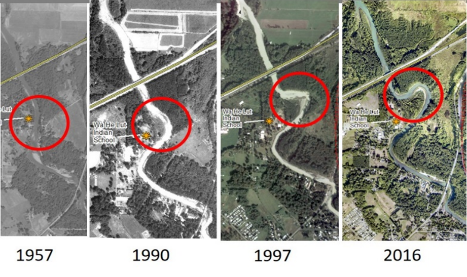
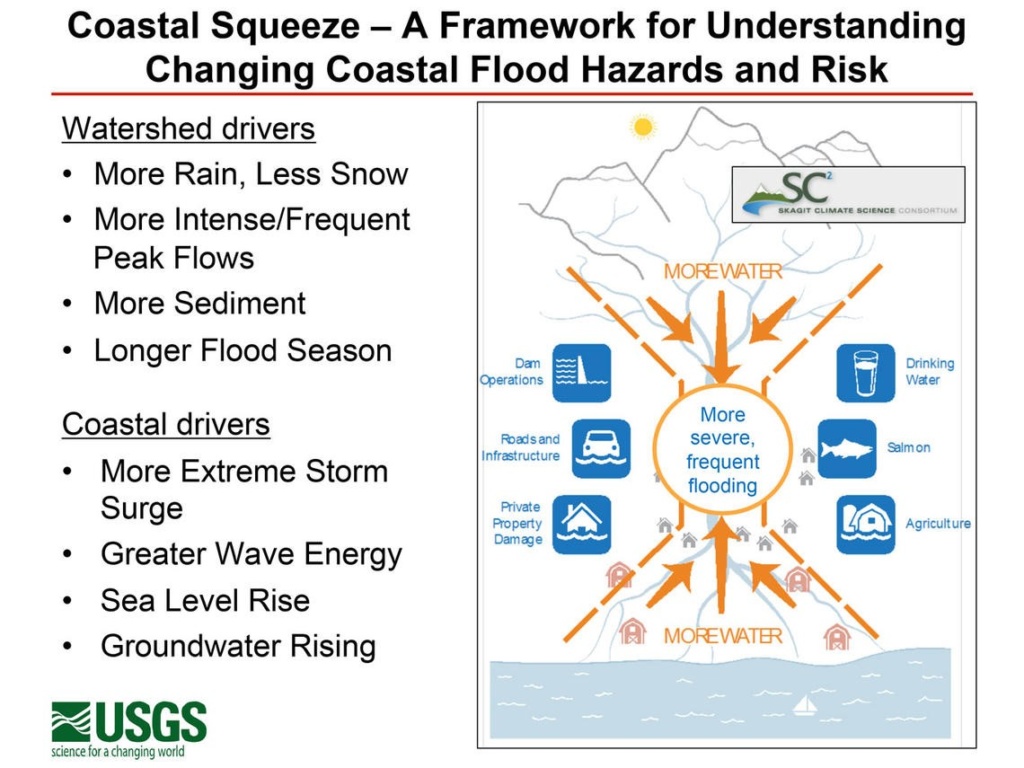
SSMCP believes investing in the I-5 Nisqually corridor should be a legislative priority. Preliminary findings of the USGS hydrologic study find that I-5 will be over topped by Nisqually River flooding. USGS lead scientist, Eric Grossman stated, “it is not if, but when”. The combination of global warming leading to sea level rise, channel reorientation, more prolific rain events, and snow melt will result in the 100-year flood occurring 4-5 times more frequently than historic norms (22-23 year event). The science tells us that in as little as 17 years flooding events will become much more frequent in the Nisqually delta with the ox bow on the Nisqually River reaching the highway. This would result in more frequent events like the 1996 Chehalis flood but on the Nisqually delta.
Please contact South Sound Military & Communities Partnership (SSMCP) Program Director, retired Colonel William Adamson, at 253-983-7772 or badamson@cityoflakewood.us for more information regarding these events and SSMCP initiatives.
SSMCP stakeholders, in order to improve the region’s transportation system performance and protect environmentally sensitive areas, as an initial step, ask $7.5M be allocated toward development of an alternative I-5 highway design. SSMCP asks the Legislature to invest along the Nisqually River Delta to restore impaired ecosystems, mitigate the flood risk to I-5 and increase highway capacity through the corridor.